New Ethernet support for the Leica GeoAce RTK base station provides farmers with consistent and accurate positions
Today, Leica Geosystems Agriculture has released the support for the Ethernet port for the Leica GeoAce
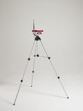
(PresseBox) - Currently the RTK base station utilizes SIM card data for network coverage. With the additional support for an Ethernet port the base station has the option to connect directly to an Internet modem where mobile coverage may not be optimal.
In August, Leica Geosystems Agriculture released the new generation RTK base station. The preliminary release supports; open formats for further cross compatibility, the ability to import and export data for reference positions and configurations, and provides access to Leica Virtual Wrench(TM) the web based remote service and support tool.
By connecting directly to an Internet modem the Leica GeoAce can be set up as a permanent base station which assists farmers by providing a consistent high rate of data transfer. In comparison to a mobile SIM card data plan which can be unreliable with signal drop outs therefore delivering an inaccurate RTK position.
"After the initial release of the GeoAce, we had feedback from customers requiring support for an Ethernet port to receive a more reliable Internet connection. Solid mobile coverage in the field is very important to our customers and we are pleased we can offer this addition," said Derek Walsh, General Manager Australia, Leica Geosystems Agriculture.
For more information about Leica Geosystems agriculture products visit www.AgGuidance.com
Whether looking to reduce input costs and increase productivity through more efficient application, or save on time and operator fatigue by lowering the number of passes in the field, Leica Geosystems provides farmers with a suite of simple, reliable and affordable agricultural guidance and precision farming tools.
Leica Geosystems' Ag Guidance solutions combine state-of-the-art positioning technology with robust, compact hardware built to withstand the toughest field conditions. Compatible with a wide range of vehicles and third party equipment and modular in software design, Leica Geosystems' products are flexible and scalable to suit individual requirements.
Leica Geosystems - when it has to be right
With close to 200 years of pioneering solutions to measure the world, Leica Geosystems products and services are trusted by professionals worldwide to help them capture, analyze, and present spatial information. Leica Geosystems is best known for its broad array of products that capture accurately, model quickly, analyze easily, and visualize and present spatial information.
Those who use Leica Geosystems products every day trust them for their dependability, the value they deliver, and the superior customer support. Based in Heerbrugg, Switzerland, Leica Geosystems is a global company with tens of thousands of customers supported by more than 3'500 employees in 28 countries and hundreds of partners located in more than 120 countries around the world. Leica Geosystems is part of the Hexagon Group, Sweden.


Datum: 05.02.2013 - 09:36 Uhr
Sprache: Deutsch
News-ID 226123
Anzahl Zeichen: 3146
contact information:
Town:
Brisbane/Heerbrugg
Kategorie:
Manufacturing & Production
Diese Pressemitteilung wurde bisher 333 mal aufgerufen.
Die Pressemitteilung mit dem Titel:
"New Ethernet support for the Leica GeoAce RTK base station provides farmers with consistent and accurate positions"
steht unter der journalistisch-redaktionellen Verantwortung von
Leica Geosystems Pty Ltd (Nachricht senden)
Beachten Sie bitte die weiteren Informationen zum Haftungsauschluß (gemäß TMG - TeleMedianGesetz) und dem Datenschutz (gemäß der DSGVO).